The Raddest ‘blog on the ‘net.

Saturday, May 19, 2007

Canyon Chronicles (Part III)

Escalante River to Chop Rock Canyon

Examining our topo map, another side-canyon beckoned–Choprock Canyon. It’s on the other side of the Escalante, and not over a mile away from camp. Our plan for the next day was to do a day hike there. After breakfast, We thrashed down through the nasty walls of tamarisk bordering the Escalante, and forded the river. The knee-deep water was easy to walk in if you were wearing boots, but Reed had elected to wear Crocs. They were so sloppy, he had no traction, and the shoes’ big holes let sand and gravel get inside. Mostly, I just waded in wearing my big boots. The wet insides and soaking socks caused me no problems. Chuck wore river shoes all the time, both in the water and on land. For the first 3 days, they were fine.

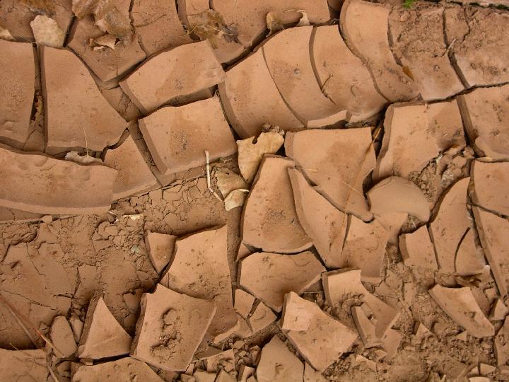
After we got into Chop Rock, there were no tamarisks. We found that to be true in most of the side-canyons. For some reason, tamarisks infested only the big canyons. We followed the twists and turns up Chop Rock for a mile or so, and took the right branch at a fork. We stopped when it came to an abrupt cul-de-dac where a dry waterfall dropped from a narrow cleft about 30 feet up. A mysterious Greek PSI marked the point where the waterfall would be gushing out after a rainfall. Is the PSI a natural freak of algae or moss? Is it a petroglyph? Hard to say.

Reed had spoken earlier about iridescence of the desert varnish. We saw it several places in Chop Rock. Desert varnish is usually black or brown. Here, with the canyon wall illuminated at an angle by the lowering sun, in many places it was an iridescent blue. We also peered up at concentric semi-circles in the rock of the walls. The semi-circles in some cases looked painted on the walls, in other places, they appeared to be carved. I asked Chuck, our transient geologist about the reason for the arcs. “Concoidal fracturing”, was his answer. But the process itself had never been explained to him, and so we left the side canyon only having learned a new geological phrase, but essentially unilluminated.

We wondered about the llama trips. Several places we had spotted llama tracks, and we had heard about llama trips starting down the river from the town of Escalante. How do the llamas penetrate the bamboo-like walls of tamarisk that line the river? Whenever a meander pinned us between a wall and the river, we were forced to find a ford and then struggle through to the bank. Often, if we couldn’t find a well-beaten trail (and some times even if we could), we’d have to hunt up and down stream for a place we could hack through the tami walls. (Oh for a light saber!) It wasn’t ever a pleasant exercise, and it was hard to imagine a llama doing it. No horse or burro could.

Here and there on sloping canyon walls, there appeared to be patches of snow. Impossible! Coming closer we saw that it was immense spreads of Cottonwood Cotton. Immediately I thought of a use for it. Chuck had been feeling pain in his heel where a blister had appeared. He put two layers of moleskin on it. But would Cottonwood cotton have done as well?

On one of the canyon walls we saw a petroglyph carved by a Mormon explorer. 1 8 T 1917, or perhaps I B T 1917. Was this guy trapped by snow or a flood, or running out of food? The canyons have many mysteries.

Back at camp while cooking dinner, we watched some bumble bees chasing each other around a big dead log. Was this a territorial battle, or a mating ritual? Two bees chased each other madly, apparently colliding at one point in their trajectories. One of the bees headed away and circled a nearby cottonwood tree. Then he sped full tilt into the tree and bounced off it to the ground. He staggered a bit, then stopped and fell over dead. Reed picked him up and we looked at him. Was it suicide by a spurned lover? Or had he been damaged–maybe blinded–by a fight with his rival?

When the sun set, we watched the moon through the black spidery branches of the cottonwoods. Venus and Saturn sparkled in the west and south. There was too much moonlight to see the Milky Way until long after bed time. Chuck said he saw it at about 2 am when he got up to answer nature’s call. I promised myself that I’d get up, but I blew z’s soundly all night long.

Photo Gallery

–rakkity

posted by michael at 7:53 am  

Monday, May 14, 2007

Roofs and Gators

the_gang.jpg

Mike,

Katie just sent us some pictures of her latest construction work in Thibodeaux. But it’s not all work down there in steamy Louisiana. She also went with her buddies on a swamp tour.

–rakkity

posted by michael at 6:39 am  

Thursday, May 10, 2007

The Healing Sacrifice of Aberrant Flesh

For a handful of days, I had pondered upon the summons of the Medicine Shaman of the House of Or, who had demanded my appearance at a healing rite which I could not afford to miss, since it could determine my stay in this plane of existence. Duly advised, on the appointed day, when the Sun had reached his zenith, I appeared before the vestals of the House of Or and permitted them to prepare me for the destined rituals of healing. They garbed me in the thin flaxen garments that initiates must wear in the rites, and with soothing words, they led me into the outer vestibules of Or and gently laid me down on a low wheeled table. 

The lead Sorcerer entered and identified himself as An-es Theticos of Lethe. He appeared young and vigorous, and wore the sage-green robes of the House of Or.

Guided by the Sorcerer, I rode supine on the rolling table into Or’s inner chamber. As we slid smoothly through the white corridors, An-es questioned me on my preferred mode of entry into the realms of
Sensory Diminution required for the healing rite, and counseled me to accept the mode of Lower Paralysis with an easy heart. I expressed my preference for the common mode of Blind Oblivion, but his words persuaded me, and I accepted his advice with only a slight reluctance.

My supine body was pushed under a powerful bluish beam cast by an intense square of light inset in the high ceiling of the chamber.

The assisting minions of Or carefully transferred me onto the Platform of Diminution, while close to my feet, the chief Shaman toyed with his arcane tools of writhing mechanical snakes and other obscene machines. An-es rolled me sideways and pricked me in my backbone with a flinty hollow tool impregnated with one of his magic potions. The forewarned paralysis soon progressed, first in my toes and feet, then my ankles, then my legs and finally my hips. There, to my relief, the deadness stopped, leaving my upper body’s muscles and senses intact. My nervousness abated, and I gazed with curiosity at the rites being enacted.

Off in the seeming misty distance, the Shaman lifted a dead leg, apparently not my own, but somehow connected to my body, and placed it high. A deep relaxation crept over me as the potions had their way. I watched dimly as from afar, while the Chief shaman chanted secret words to his greybeard assistant. Hidden from my eyes by a low curtain, the Shaman worked his incantations and unfelt fetish manipulations on my nether parts. Strange and ghostly images slid across two great square lenses to either side of me. The Shaman spoke his toneless words as he peered into the patterns of light and dark and studied the shadows of fire and flow in the magic lenses. In due course, the Shaman made his final anointing and secreted the acquired aberrant flesh into a magic vial. In an emotionless voice he announced the conclusion of the ritual.

Quietly, while the session was tending toward its conclusion, my Sorcerer guide An-es had queried me about my recent vision quest to the desert canyons to the west of our village. He responded to my descriptions of the red lands with signs of pleasure, as he too had visited the depths of the canyons during the very same lunar cycle. I took this as an ineluctable omen of connectedness.

The mystical session of the House of Or now complete, An-es rolled me back from the sacrificial platform onto my table, and the Shaman spoke again in a clear voice. He pronounced his satisfaction with the healing rite, and expressed his belief that the gods of Or might have been propitiated. But he made it clear that I should complete my performance of the sacrifice by mutual sharing of words after the gods of the House of Pathologix had expressed to him their satisfaction or displeasure with the sacrifice. I would learn their pronouncements in a matter of days, which might foretell my fate.

An-es had promised my semi-paralysis would depart within hours. And indeed, by evening it had left by stages in reverse order, starting from the hips and progressing slowly to the toes. By nightfall my limbs had completed their return to life. Tomorrow, if other signs were propitious, I would return healed to my own heath and hearth.

–rakk-slightly diminished

posted by michael at 9:46 pm  

Thursday, May 10, 2007

Canyon Chronicles (Part II)

Harris to Escalante to Silver Falls Creek

After passing through some fine narrow streches in Harris, we could see a castle-like tower. This tower, shown on the topo map, stood just above some benches on the Escalante, so we knew we were close. By a raven’s route, we were close, but we had to nearly circumnavigate the great tower in the last meander of Harris Wash before we reached the river. Late in the afternoon we reached a fine camp full of blue Pepsisewa flowers. It was time to sit back and toast our arrival with a jigger of Bowmore (Reed’s gift), AAdamx?x Islay (Chuck’s gift), or Irish Whiskey (my gift). Our plans for the next day developed: Tomorrow would be a rest day. We’d cross the Escalante and hike across to Silver Falls Creek and hike the canyon there with just day packs on.

It rained all night–about an inch–but the downpour stopped about 9 am, late enough to make us worried that we’d have to cook breakfast in the rain. Our tents didn’t leak, but my boots were full of water when I finally got out to look where I had hung them to dry overnight. But after a fine oatmeal breakfast (all breakfasts are fine when you’re starving hungry), we got out for the day’s hike by the crack of 11 am. We’d ford the Escalante and search downstream for a side-canyon shown on our map.

The canyon containing Silver Falls Creek turned out to be a beautiful one with walls peppered with old little huecos and small arches. (None were bigger than a foot or so high, so don’t mistake them to be bigger than that in the slides.) The creek ran thin and silvery under overhanging redwalls. We didn’t have time to explore the upper reaches of the canyon, but we found from the map that it’s possible to hike down from the opposite rim. Someday we’ll have to do that.

My words can’t do justice to the canyon. Let my pictures speak!

–rakkity

posted by michael at 6:24 am  

Thursday, May 3, 2007

Canyon Chronicles (Part 1)

arid.jpg

Saturday, April 21

In the little town of Escalante, we found out where our contracted shuttle driver was located–the Outfitter/bar/tee-shirt-shop/pizza joint–and made final arrangements. He would lead us to 25-Mile Wash where we’d drop our car, and drive us to the trailhead at Harris Wash. Then we’d hike down Harris toward the Escalante River, down the river, and then up 25-Mile Wash to our truck. A jaunt of about 35 miles that we could easily (?) do in 6 days.

We scarfed down our last good pre-hike food (pizza) at the Outfitter, and followed the Shuttle guy’s truck down the gravel Hole-In-The-Rock road toward 25-Mile and Harris. We left our truck at the site he designated, and then rode with him to our trekking-off site.

Hiking down the Harris Wash trail, Chuck and I were contemplating the view, but Reed was fiddling with his new GPS. He had (luckily, as it turned out) set a “Waypoint” on the GPS at the location where our shuttle driver had left our truck, and then set another one at the Harris Wash trailhead, but he couldn’t figure out how to extract the coordinates to compare with our topo maps. Finally at a rest stop he worked out where the trailhead was, and after some puttering around we decided, that our shoulders testified to many eastward miles, we hadn’t even reached the west edge of our topo.

The clouds loomed dark and thick in all directions. We were uncormfortably aware that the weather man had predicted rain for tomorrow and Monday, so we hoped to reach camp and put up shelter, just in case the rains came early.

After a multi-mile trudge through heavy thickets of tamarisk–an illegal immigrant from Siberia that chokes the shores of most western streams–we finally arrived at the entrance to the Glen Canyon Recreation Area, and, coincidentally, the west edge of our topo map. Now we were in “known” territory. At another rest stop, Reed finally figured out how to get the coordinates of the GPS Waypoints, and he informed us where the car was. Unfortunately, our shuttler had parked us at a point in 25-mile Wash all right, but about 5 miles upstream from where we expected to be. So it looked like we’d have some extra hiking to do on the last day of the trip.

After entering the GC Rec Area, the canyon walls rose higher, the canyon narrowed, and the stream started meandering. The views were prettier, but we had to make many more stream crossings. Chuck had river shoes, but Reed and I, if we wanted to keep some dry boots, had to alternate between Crocs and boots. After the 5th or 6th crossing, I said, “The heck with staying dry”, and just walked into the creek at every ford with my big boots on. Comfort-wise, the wetness made no difference, I was surprised to find.

About the time the sun was settling behind the canyon walls, we reached a nice camp site and set up the 2-man and 1-man tents. We hung up our boots and clothes to dry in the warm desert breeze, and cooked up a well-deserved freeze-dried dinner using our handy butane stoves. The next day, we hoped, we’d toddle up, sans backpacks, to Silver Creek Falls in a side-canyon of that name on the other side of the Escalante river.

Photo Album

Next: The Escalante and Silver Falls Creek Canyon

-rakkity

posted by michael at 6:41 am  

Monday, April 30, 2007

The Canyon Chronicles – Prologue

DATE: April 3
SUBJECT: The canyon lands
TO: the fogies4
FROM: Phil
Guys,

I’m happy to report that I will be able to make the canyon lands trip.
I will arrive in Grand Junction, if the flight is on time, at 2:32 on the
20th.
Phil

DATE: April 15
SUBJECT: The canyon lands
TO: the fogies4
FROM: Phil
Guys,
I cannot make this trip after all. I’ve developed what appears to be a radiculopathy, i.e, a pinched nerve in my back.

Won’t know about the future till I get more information, hopefully next week, but I’m definitely out of action for this trip.

Hope you guys have a great time. I would really liked to have been along.

Phil

DATE: April 15:

DATE: April 16
SUBJECT: Now it’s a 3-man trip
TO: the fogies4
FROM: ed

Guys,

Well, I guess we should take Chuck’s 1-man tent and someone’s 2-man tent. I’ll leave it to you guys to sort out the common gear. What I have is too common to be common.

Ed

DATE: April 17
SUBJECT: Dropping like flies
TO: the fogies4
FROM: ed

Guys,

I may have a urinary tract infection. I’ll have to wait to see what the doctors say about me going on the trip.

Ed

DATE: April 18
SUBJECT: Dropping like flies
TO: the fogies4
FROM: ed
Guys,

It looks like I can go to Escalante after all!
I’m on an antibiotic (Cipro), and I’m supposed to drink lots of water, so I’m bringing 4 1-liter water bottles.

Now we’re on track for leaving on the 20th.

Ed

DATE: April 18
SUBJECT: Dropping like flies
TO: the fogies4
FROM: reed
Ed- you are a good man. I thought it would be okay to take the antibiotics with you on the trail. Chuck and I will make sure you take it religiously twice a day. It goes down well with the scotch. See you on Friday.

Reed

DATE: April 18
SUBJECT: Dropping like flies
TO: the fogies4
FROM: chuck

Whew! Back on track.

Chuck

DATE: April 20

–rakkity

posted by michael at 7:42 pm  

Saturday, April 21, 2007

Boulder Bronzes

Michael,

Boulder is an amazing town to bike through or walk through. There are spectacular bronze/steel/brass statues, busts, and plaques all over town. There may be more per sq km here than even D.C. I’m not sure. Attached is a jalbum of 13 that I’ve collected in the last couple of days. The Mrs sez there are at least a dozen more that I’ve missed, and I will try to collect them in the coming days. Alas, my pictures don’t do justice to the real thing. The lighting wasn’t right, the backgrounds interfere, my camera and brain aren’t up to the job….So consider this a work in progress.

rakkity

PS: Next on my list of partially finished projects is “Boulder’s Bumper Stickers,” and then comes “Boulder’s Curious Business Names.” Stay tuned.

posted by michael at 7:20 am  

Thursday, April 19, 2007

Frosted Blossoms

Michael,

Back in tropical Balmie (oops, I mean Bowie), Maryland, our spring blossoms rarely got frosted. But just after our local cherry trees blossomed out, we got a heavy ice storm. So I went out to shoot some closeups of the ice that encased everything. Then a snow came, but soon after, I was surprised to see that every flower survived.

–rakkity

posted by michael at 6:39 am  

Wednesday, April 18, 2007

Doomed(?) Tulips

Michael,

We have pretty tough tulips out here. When I first shot this weekly/daily/hourly sequence of the tulips in our front yard, I thought the tulips were doomed by the ice storm and snowfall on Easter weekend. But on Easter Monday, they revived and are still thriving.

–rakkity

posted by michael at 7:16 am  

Tuesday, March 27, 2007

The view from 75th St, Boulder, CO

viewFrom75thSt.jpg

Hi Mike,

Knowing your love of panos, I’m sending a first cut at a 7-panel shot I made from the east side of Boulder a couple of weeks ago. This is not the final version–there are lots of joints visible, and the exposure varies from picture to picture, and there are 2 more photos to be pasted in at the left end. But what the heck, it’s a beginning. There have been some much better days with more snow on the foothills, but I couldn’t get out to the vantage point at the right time. As the fields green up this month, we’ll have even better views to make a better pano.

rakkity

posted by michael at 5:32 pm  

Friday, March 16, 2007

Katie’s Americorps Experience

(Feb – Mar 2007)

Hi Mike,

Thought you and the blog would like to hear about daughter Katie’s amazing experiences in Americorps. I’ve put together a slide show using a bunch of Katie’s photos. (It was done with jalbum, which we all have come to know and love.)

Americorps has paired up with Habitat for Humanity in doing their re-building projects on the gulf coast, which explains the first slide.

Katie started Americorps training in Denver (first 13 slides), where Americorps has taken over part of Loretta College, formerly a women’s college, and now owned by a Japanese corporation. She and her team members took buses to downtown, so some of the shots are of downtown sights.

After training, her team drove down in vans to NM, then TX, and finally LA, where they were to work. Along the way they saw the ruined homes of New Orleans (5 shots). Then they went further south to Thibodaux, which wasn’t quite as damaged as New Orleans. At least the homes are on higher ground. (7 shots show her new digs, and 8 show food that was provided them by a local church congregation).

The last 14 shots show the actual reason they went down to Thibodaux. They built a house from the foundation on up. Katie specialized in hammering studs and putting roof trusses together.

Now that they’ve finished roughing out one house, they’ll go on to another, and maybe a third, before Katie’s team returns to Denver.

–rakkity

posted by michael at 9:42 pm  

Friday, March 16, 2007

Katie's Americorps Experience

(Feb – Mar 2007)

Hi Mike,

Thought you and the blog would like to hear about daughter Katie’s amazing experiences in Americorps. I’ve put together a slide show using a bunch of Katie’s photos. (It was done with jalbum, which we all have come to know and love.)

Americorps has paired up with Habitat for Humanity in doing their re-building projects on the gulf coast, which explains the first slide.

Katie started Americorps training in Denver (first 13 slides), where Americorps has taken over part of Loretta College, formerly a women’s college, and now owned by a Japanese corporation. She and her team members took buses to downtown, so some of the shots are of downtown sights.

After training, her team drove down in vans to NM, then TX, and finally LA, where they were to work. Along the way they saw the ruined homes of New Orleans (5 shots). Then they went further south to Thibodaux, which wasn’t quite as damaged as New Orleans. At least the homes are on higher ground. (7 shots show her new digs, and 8 show food that was provided them by a local church congregation).

The last 14 shots show the actual reason they went down to Thibodaux. They built a house from the foundation on up. Katie specialized in hammering studs and putting roof trusses together.

Now that they’ve finished roughing out one house, they’ll go on to another, and maybe a third, before Katie’s team returns to Denver.

–rakkity

posted by michael at 9:42 pm  
« Previous PageNext Page »

Powered by WordPress